



XXL Wall Map of Europe with Country Flags, Capitals, Roads and Railways – Detailed Political Map at 1:2,000,000 Scale - Maps International
Political Europe Map with Country Flags – English – XXL 260 x 190 cm
from €149.00
Size ca.: 260 x 190 cm
Scale: 1:2,000,000
Sku: 110058DIGXXL_
Of course, the watermark is not present on the printed map.
Political Europe Map with Country Flags – English – XXL 260 x 190 cm
Political Europe Map with Country Flags – English – XXL 260 × 190 cm
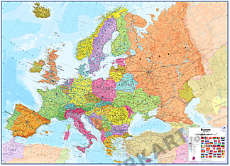
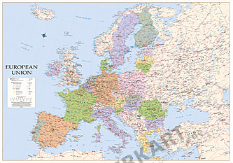
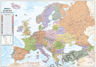
This detailed political map of Europe with country flags combines a colorful representation of the European continent with extensive geographical information. The different country colors make geographical orientation easier and give the map an informative and decorative appearance. A separate panel featuring European national flags complements the map and provides an additional reference for exploring the countries of Europe.
With its impressive dimensions of 260 × 190 cm and a scale of 1:2,000,000, this XXL Europe map offers an exceptionally large representation of the European continent. In addition to countries, capitals and numerous cities, it displays important road connections, railway lines and further geographical information. This makes the map an excellent geographical reference as well as a practical resource for planning and presentations in businesses, offices and educational institutions.
What information does the Europe map show?
The political Europe map displays European countries with their international borders, administrative boundaries and disputed borders. Capitals and numerous additional cities and towns are marked with different symbols according to population size, making it easy to distinguish major metropolitan areas from smaller towns.
One of the map's most useful features is its extensive European transport network. It includes highways, European routes, major roads, minor roads and important railway lines. Road numbers and route designations help users identify connections within and between European countries. Airports and selected mountain summits are also marked.
A separate country flag panel featuring European national flags complements the map. It allows users to quickly associate national flags with their respective countries and adds further geographical reference value.
By combining political geography, detailed road connections and country flags, the map is particularly suitable for geographical orientation, education and the planning of international business activities.
Language: English
Scale: 1:2,000,000
Size: 260 × 190 cm (XXL)
What size and scale does the Europe map have?
Measuring 260 × 190 cm at a scale of 1:2,000,000, this XXL political Europe map provides an exceptionally large and clear representation of the European continent. Its generous map surface allows numerous place names, national borders and transport connections to be read comfortably.
The map is particularly suitable for large offices, conference rooms, schools, universities, reception areas, logistics companies and internationally operating businesses. Its large dimensions also make it easy for several people to view and discuss geographical information together.
The 260 × 190 cm size makes the map an impressive visual feature in representative business premises and spacious living areas.
Which finishes are available?
The political Europe map is available in four different finishes, allowing you to select the version that best suits your intended use.
Paper Map
The classic paper version is printed on high-quality paper and is ideal for custom framing or flexible wall decoration. It is an excellent choice for customers looking for a lightweight XXL wall map who prefer to choose their own mounting method.
Double-Sided Laminated Map
Double-sided lamination provides the Europe map with a durable and protected surface. It can be written on with suitable water-soluble transparency markers and wiped clean with a dry cloth afterwards. This allows travel destinations, sales territories or company locations to be marked and updated as needed. This finish is particularly practical for teaching, planning and regular use.
Pinboard with Silver Aluminum Frame
The map is mounted on a 10 mm thick foam board, laminated and finished with a slim silver-colored aluminum frame. Pins can be used to mark company locations, branches, sales territories or travel destinations directly on the map. The laminated surface can also be written on with suitable transparency markers and wiped clean afterwards.
Magnetic Board with Silver Aluminum Frame
For this finish, a metal sheet is first attached to a 10 mm thick foam board. The map is then mounted, laminated and finished with a high-quality silver-colored aluminum frame. Magnets allow flexible marking of company locations, areas of responsibility, delivery regions or travel destinations. The laminated surface can also be written on with suitable transparency markers and wiped clean afterwards.
Our pinboards and magnetic boards are individually handcrafted in our own workshop in Germany. Each map is carefully mounted, finished and framed.
How is the Europe map shipped?
Shipping depends on the selected finish and takes into account the exceptional dimensions of this XXL Europe map.
Paper Maps & Laminated Maps
Paper maps and double-sided laminated maps are carefully rolled, securely packed and shipped in sturdy protective packaging. This helps protect the map against creases and damage during transportation.
Pinboards & Magnetic Boards
The large-format pinboards and magnetic boards are shipped in specially developed, sturdy protective packaging for framed wall maps. Due to their exceptional dimensions, delivery is arranged by freight carrier.
Where can the Europe map be used?
The colorful political representation, extensive transport network and integrated European country flag panel make this XXL Europe map a versatile combination of geographical reference material and decorative wall design.
It is particularly suitable for international companies, logistics centers, sales departments, travel agencies, schools, universities, offices and conference rooms. The detailed road network supports geographical orientation and provides a useful reference for visualizing company locations, sales territories and international business activities.
The map is also valuable for geography lessons and travel planning, offering numerous opportunities to explore European countries, cities and transport routes. The separate flag panel provides additional geographical information and makes it easier to identify European national flags.
Depending on the selected finish, company locations, sales territories, delivery regions or travel destinations can be marked with pins, magnets or suitable transparency markers. The political Europe map is also an attractive choice for informative wall decoration in spacious living areas.


| SKU | 110058DIGXXL_ |
|---|---|
| EAN | 4260030051496 |
| Manufacturer | Maps International |
| Finish | paper, double-sided laminated, framed pinboard (silver color), framed magnetboard (silver color) |
| published Year | 2026 |
| Create own map | Yes |
| Language | english |
| scale | 1:2,000,000 |
Manufacturer information
Different clipping? Larger map view?
Contact us about the possibilities of this map:
Fon: 04107 5676 or email: shop@interkart.de