The store will not work correctly in the case when cookies are disabled.
  • English
  • German
  • Danish
Links
  • +49 4107 5676
  • Contact Us
  • Sign In
  • Create an Account
Toggle Nav interkart.de
Advanced Search
Cart 0
Shopping Cart
Menu
World Maps
World Maps

World Maps

Large selection of political, physical and historical world maps. You can order our world maps as laminated poster, pinboard, magnetic board, with or without frame.

Political World Maps

politische Weltkarte

Physical World Maps

physikalische Weltkarte

Historical World Maps

antique world maps

Pinboard / Magnet board

Pinnwand / Magnetwand

World Maps for Children

Kinderweltkarte

more world maps

National Geographic World Maps
Decorative World Maps
Digital Maps
Accessories
Wall Maps from A-Z
Wall Maps from A-Z
Continents
Continents
Europe
America
Africa
Asia
Australia
Arctic / Antarctica
Country Maps
Country Maps
Europe
North America
Central- and Southamerica
Asia
Africa
New Zealand
Maps of Germany
Postcode Maps
Postcode Maps
Postcode Germany
Postcode Europe
PLZ International
City Maps
Butterfly Poster
Satellites / Space Poster
National Geographic Maps
Europe
USA
US States / Topic Maps
Continents
Country Maps
Nature Environment
Universe Maps
Antique Maps
Antique Maps
NG Collection Maps 1899 - 1976
Antique Maps 1740 - 1900
Pinboard / Magnetic Board
Digital Maps
Accessories
Large Wall Maps in XXL
Maps as wallpaper
Huge World Maps
Huge Europe Maps
Large Maps
Digital Maps
Accessories
3D Relief Maps
3D Relief Maps
3D World Map
3D Maps of Europe
3D USA + US States
3D Country and Regional Maps
Antique and historic maps
Antique World Maps
Antique Continent Maps
Antique Country / Region Maps
Antique City Maps
Special Maps
Globes
Globes
Inflatable Globes
Illuminated Globes
Hand Finished Globes
Globes for Children
Historical Globes
Double Image Illuminated Globes
3D Surface Globes
Accessories
Contact Us
Account
Language
  • English
  • German
  • Danish
februar2024
nr.3_EN_Angebote
Interkart Imagevideo
  • Home
  • Antique and historic maps
  • Continent Maps
  • Europe

Europe

Europe

In this section you take a stroll through European history.

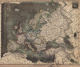
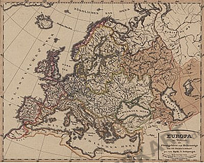
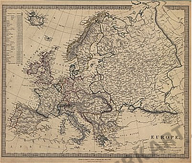
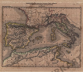
Here you will find historical maps of ancient Europe, including the Western Roman Empire, the Persian Empire, the Empire of Charlemagne and many more.

It also contains maps of Northern Europe, Central Europe and Southern Europe, a people map, a map of the river areas and mountain ranges and many more.

Discover our home continent Europe in the course of history!

Filter

39 Items

Set Descending Direction
  1. 1801 - Europe (Replica) 41 x 32cm
    1801 - Europe (Replica) 41 x 32cm
    €29.00
    Incl. VAT , excl. Shipping Cost
  2. 1841 - Europe
    1841 - Europe
    €20.00
    Incl. VAT , excl. Shipping Cost
  3. 1859 - Europe
    1859 - Europe
    €20.00
    Incl. VAT , excl. Shipping Cost
  4. 1825 - Europe
    1825 - Europe
    €20.00
    Incl. VAT , excl. Shipping Cost
  5. 1881 - Europe political (Replica)
    1881 - Europe political (Replica)
    €29.00
    Incl. VAT , excl. Shipping Cost
  6. 1881 - Atlantic Ocean (Replica)
    1881 - Atlantic Ocean (Replica)
    €29.00
    Incl. VAT , excl. Shipping Cost
  7. Völkerkarte von Europe (Replica)
    Völkerkarte von Europe (Replica)
    €29.00
    Incl. VAT , excl. Shipping Cost
  8. 1856 - Europe zur Übersicht der Flussgebiete und Höhenzüge
    1856 - Europe zur Übersicht der Flussgebiete und Höhenzüge
    €30.00
    Incl. VAT , excl. Shipping Cost
  9. 1836 - Europe (Replica)
    1836 - Europe (Replica)
    €29.00
    Incl. VAT , excl. Shipping Cost
  10. 1865 - Europe (Replica)
    1865 - Europe (Replica)
    €29.00
    Incl. VAT , excl. Shipping Cost
  11. 1839 - Europe
    1839 - Europe
    €30.00
    Incl. VAT , excl. Shipping Cost
  12. 1854 - Europe (Replica)
    1854 - Europe (Replica)
    €29.00
    Incl. VAT , excl. Shipping Cost
  13. 1840 - Map of Europe 1855 - (Replica)
    1840 - Map of Europe 1855 - (Replica)
    €29.00
    Incl. VAT , excl. Shipping Cost
  14. 1867 - Europe (Replica) 39 x 50cm
    1867 - Europe (Replica) 39 x 50cm
    €29.00
    Incl. VAT , excl. Shipping Cost
  15. 1867 - Europe 39 x 50cm (Replica)
    1867 - Europe 39 x 50cm (Replica)
    €29.00
    Incl. VAT , excl. Shipping Cost
  16. 1867 - Europa all` Epoca delle Crociate (Replica)
    1867 - Europa all` Epoca delle Crociate (Replica)
    €29.00
    Incl. VAT , excl. Shipping Cost
  17. 1824 - Europe (Replica)
    1824 - Europe (Replica)
    €29.00
    Incl. VAT , excl. Shipping Cost
  18. 1850 - Das West-Römische Reich bis zu seinem Untergang (Replica)
    1850 - Das West-Römische Reich bis zu seinem Untergang (Replica)
    €29.00
    Incl. VAT , excl. Shipping Cost
  19. 1850 - Das Reich Carls des Grossen (Replica)
    1850 - Das Reich Carls des Grossen (Replica)
    €29.00
    Incl. VAT , excl. Shipping Cost
  20. 1828 - La Europa Politica
    1828 - La Europa Politica
    €25.00
    Incl. VAT , excl. Shipping Cost
  21. 1856 - Europe
    1856 - Europe
    €45.00
    Incl. VAT , excl. Shipping Cost
  22. 1850 - Mittel und Südeuropa
    1850 - Mittel und Südeuropa
    €35.00
    Incl. VAT , excl. Shipping Cost
  23. 1850 - Geschichte bis zu Zeit der Blüte des Persischen Reichs un
    1850 - Geschichte bis zu Zeit der Blüte des Persischen Reichs un
    €40.00
    Incl. VAT , excl. Shipping Cost
  24. 1850 - Europäischen Reiche Anfang des VI. Jahrhunderts
    1850 - Europäischen Reiche Anfang des VI. Jahrhunderts
    €40.00
    Incl. VAT , excl. Shipping Cost
  25. 1850 - Gallien, Britannien, Germanien und die obern Donau-Länder
    1850 - Gallien, Britannien, Germanien und die obern Donau-Länder
    €35.00
    Incl. VAT , excl. Shipping Cost
  26. 1850 - Hispania, Süd-Gallia,Italia und Africa
    1850 - Hispania, Süd-Gallia,Italia und Africa
    €30.00
    Incl. VAT , excl. Shipping Cost
  27. 1850 - Übersichs-Karte der Europäischen Staaten seit 1815 (Replica)
    1850 - Übersichs-Karte der Europäischen Staaten seit 1815 (Replica)
    €29.00
    Incl. VAT , excl. Shipping Cost
  28. 1850 - Übersichs-Karte der Europäischen Staaten für's Jahr 1810
    1850 - Übersichs-Karte der Europäischen Staaten für's Jahr 1810
    €35.00
    Incl. VAT , excl. Shipping Cost
  29. 1850 - Europäische Reiche vom Tode Friedrichs d. Gr. bis zur Fr (Replica)
    1850 - Europäische Reiche vom Tode Friedrichs d. Gr. bis zur Fr (Replica)
    €29.00
    Incl. VAT , excl. Shipping Cost
  30. 1850 - Europa in der Zeit von der Reformation bis zum westphälischen Frieden (Replica)
    1850 - Europa in der Zeit von der Reformation bis zum westphälischen Frieden (Replica)
    €29.00
    Incl. VAT , excl. Shipping Cost
  31. 1850 - Zeit vom Westphälischen Frieden bis zum Span. Erbfolge Kr
    1850 - Zeit vom Westphälischen Frieden bis zum Span. Erbfolge Kr
    €40.00
    Incl. VAT , excl. Shipping Cost
  32. 1850 - Mittel Europa
    1850 - Mittel Europa
    €35.00
    Incl. VAT , excl. Shipping Cost
  33. 1850 - Übersichs-Karte der christl. und muhammed. Reiche zur Zei
    1850 - Übersichs-Karte der christl. und muhammed. Reiche zur Zei
    €40.00
    Incl. VAT , excl. Shipping Cost
  34. 1850 - Europe, Nordafrica and Minor Asia at 12. a. 13. century (Replica)
    1850 - Europe, Nordafrica and Minor Asia at 12. a. 13. century (Replica)
    €29.00
    Incl. VAT , excl. Shipping Cost
  35. 1532 - North Europe (Replica)
    1532 - North Europe (Replica)
    €29.00
    Incl. VAT , excl. Shipping Cost
  36. 1883 - Europe
    1883 - Europe
    €35.00
    Incl. VAT , excl. Shipping Cost
  37. 1883 - Europe (Replica)
    1883 - Europe (Replica)
    €29.00
    Incl. VAT , excl. Shipping Cost
  38. 1883 - Deutschland
    1883 - Deutschland
    €35.00
    Incl. VAT , excl. Shipping Cost
  39. 1867 - Europe
    1867 - Europe
    €55.00
    Incl. VAT , excl. Shipping Cost
Filter

39 Items

Set Descending Direction
World Maps
political world maps
physical world maps
historical world maps
Pinboard / Magnet board
world maps for children
National Geographic world maps
digital maps
Accessories
Wall Maps from A-Z
Continents
Europe
America
Africa
Asia
Australia
Arctic / Antarctica
Country Maps
Europe
Northamerica
Central- and South America
Asia
Africa
New Zealand
Maps of Germany
Postcode maps
Postcode Germany
Postcode Europe
PLZ International
Road Maps
City maps
Butterfly Poster
Satellites / Space Poster
National Geographic Maps
Europe
USA
US States / Topic Maps
Continents
Country Maps
Nature Environment
Universe Maps
Antique maps
NG Collection maps
Pinboard / Magnetic board
Digital maps
Accessories
large wall maps in XXL
Maps as wallpaper
large world maps
large europe maps
large maps
digital maps
Accessories
3D Relief Maps
3D world map
3D maps of Europe
3D country and regional maps
3D USA + US States
Pinboard / Magnetic Pinboard
Cork Pinboard
Pinboard
Magnetic Pinboard
Globes
inflatable globes
illuminated globes
double image illuminated globes
hand finished globes
3D surface globes
floor standing globes
globes for children
historical globes
Antique and Historic Maps
Historic World Maps
Historic Continent Maps
Historic Africa Maps
Africa
Historic North Africa Maps
Historic East Africa Maps
Historic South Africa Maps
Historic West Africa Maps
Historic America Maps
America
Historic Central America Maps
Historic North America Maps
Historic South America Maps
Historic Asia Maps
Historic Australia Maps
Historic Europe Maps
Historic Oceania Maps
Historic Ocean Maps
Historic Polar Maps
Historic Country / Region Maps
Historic Egypt Maps
Historic Belgium Maps
Historic British Isles Maps
Historic China Maps
Historic Denmark Maps
Historic Germany Maps
Historic England Maps
Historic France Maps
Historic Greece Maps
Historic India Maps
Historic Ireland Maps
Historic Italy Maps
Historic Yugoslavia Maps
Historic Netherlands Maps
Historic Norway Maps
Historic Austria Maps
Historic Poland Maps
Historic Russia Maps
Historic Scotland Maps
Historic Sweden/Norway Maps
Historic Switzerland Maps
Historic Scandinavia Maps
Historic Spain/Portugal Maps
Historic Czech Republic Maps
Historic Turkey Maps
Historic Ukrain Maps
Historic Hungary Maps
Historic City Maps
Special Maps
Rivers and Mountains
Astral / Celestial Maps
Kriegskarten
Relegions & Peoples
Miscellanious
Weather & Clima
Digital Maps
Digital German State Maps
Shop By
Shopping Options
Width
  1. 0.00 - 50.00

Contact

Feel free to contact us for any special wishes or questions.

Contact person:

Ken Niemeyer
+49 (0) 4107 5676
shop@interkart.de
Frau Niemeyer
Newsletter
Subscribe

We will send you regular information on our product range by e-mail. You can unsubscribe from the newsletter at any time.

Follow us

Information

  • Shipping costs
  • Delivery time
  • Payment types
  • Cancellation policy
  • Privacy policy
  • Imprint

Customer service

  • Contact us
  • About us
  • Terms and conditions
  • Maps finishes
  • Sitemap
  • Our partners

Customer account

    • Customer account
    • Order history
    • Cookie settings
    • Newsletter
    • Information on the authenticity of customer reviews

Payment method types

Rechnung for customers from Germany
Bank preypayment
AmazonPayment
PayPal
Credit card

Contact us

We are happy to help you.
Contact person:
Ken Niemeyer
Tel: +49 (0) 4107 5676
Email: shop@interkart.de

Represented by the IT-Recht Kanzlei   Fairness im Handel

© Copyright 2025 Interkart GmbH

Magento Shop created by comvos online medien